

HISTORIC PICTORIC
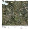
Historic Pictoric Belton Texas USGS Topographic Map Print, 2012, 1:24000, 7.5-Minute Quadrangle, Topo Wall Art Poster - 44in x 55in
NZ$1,054.78
NZ$1,757.97
-
 Order within to get between
-
 Tracked Shipping on All Orders
-
 14-Day Returns
- Secure Payments
-
 24/7 Customer Support
Description
- BELTON TEXAS TOPO MAP: This 2012 USGS topographic map documents the Belton area at 1:24000 scale in a 7.5-minute quadrangle format.
- BELL COUNTY MAP DETAIL: The source map covers part of Bell County, Texas, with roads, contours, waterways, geographic names, and local topographic detail.
- TEXAS MAP GIFT: A thoughtful wall art gift for map collectors, local history fans, or anyone decorating a study, office, or den.
- Detailed USGS topographic map featuring elevation contours, waterways, roads, geographic names, and regional landscape detail from the official United States Geological Survey mapping series.
- Professionally reproduced from historical USGS source material and printed for display, study, office decor, home decoration, genealogy research, and map collections.
Shipping and Returns
- We offer tracked shipping on all orders. Tracking information will be shared as soon as the order is dispatched.
- Please check the delivery estimate before adding a product to the cart. This is displayed for every product on the website.
- Available shipping methods and charges will be displayed at the time of checkout, depending on your exact location.
- All customers are entitled to a return window of 14 days, starting from the date of delivery of the product(s).
- Customers are advised to read our return policy for details of the return process, eligibility, refunds as well as cancellations or exchanges.
- In case of any issues or concerns about Shipping or Returns, please contact us and we will be happy to help.
Historic Pictoric.
Historic Pictoric Belton Texas USGS Topographic Map Print...
NZ$1,054.78
NZ$1,757.97