

HISTORIC PICTORIC
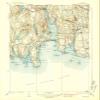
Historic Pictoric Niantic Connecticut Historic USGS Topographic Map Print, 1938, 1:31680, 7.5-Minute Quadrangle, Topo Wall Art Poster - 44in x 55in
NZ$1,054.78
NZ$1,757.97
-
 Order within to get between
-
 Tracked Shipping on All Orders
-
 14-Day Returns
- Secure Payments
-
 24/7 Customer Support
Description
- NIANTIC CONNECTICUT TOPO MAP: This 1938 historic USGS topographic map documents the Niantic area at 1:31680 scale in a 7.5-minute quadrangle format.
- NEW LONDON COUNTY MAP DETAIL: The source map covers part of New London County and Suffolk County, Connecticut, with roads, contours, waterways, geographic names, and local topographic detail.
- CONNECTICUT MAP GIFT: A thoughtful wall art gift for map collectors, local history fans, or anyone decorating a study, office, or den.
- Detailed USGS topographic map featuring elevation contours, waterways, roads, geographic names, and regional landscape detail from the official United States Geological Survey mapping series.
- Professionally reproduced from historical USGS source material and printed for display, study, office decor, home decoration, genealogy research, and map collections.
Shipping and Returns
- We offer tracked shipping on all orders. Tracking information will be shared as soon as the order is dispatched.
- Please check the delivery estimate before adding a product to the cart. This is displayed for every product on the website.
- Available shipping methods and charges will be displayed at the time of checkout, depending on your exact location.
- All customers are entitled to a return window of 14 days, starting from the date of delivery of the product(s).
- Customers are advised to read our return policy for details of the return process, eligibility, refunds as well as cancellations or exchanges.
- In case of any issues or concerns about Shipping or Returns, please contact us and we will be happy to help.
Historic Pictoric.
Historic Pictoric Niantic Connecticut Historic USGS Topog...
NZ$1,054.78
NZ$1,757.97