

HISTORIC PICTORIC
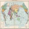
Political Map of the World, 1954 - Historical Map Print - 70in x 44in
NZ$1,274.54
NZ$2,124.23
-
 Order within to get between
-
 Tracked Shipping on All Orders
-
 14-Day Returns
- Secure Payments
-
 24/7 Customer Support
Description
- Full-color political map of the world circa 1900, from a 1954 Soviet historical atlas for secondary schools.
- Atlas plate featuring geopolitical boundaries, references, and symbol legend typical of mid-20th century cartography.
- Made-to-order historical map reproduction suitable for classrooms, offices, studies, and map collectors.
- FINE ART PRINT QUALITY: Printed on heavyweight 230gsm matte paper with archival gicle inks for crisp detail, rich tonal depth, and long-lasting display quality suitable for home, office, or gallery-style framing.
- PRINTED IN THE USA: Professionally printed on heavyweight matte paper and carefully packaged in a durable protective tube for safe delivery. Many sizes fit widely available standard frames. Each artwork is digitally restored to reduce age-related imperfections while preserving the historic texture, detail, and character of the original map.
Shipping and Returns
- We offer tracked shipping on all orders. Tracking information will be shared as soon as the order is dispatched.
- Please check the delivery estimate before adding a product to the cart. This is displayed for every product on the website.
- Available shipping methods and charges will be displayed at the time of checkout, depending on your exact location.
- All customers are entitled to a return window of 14 days, starting from the date of delivery of the product(s).
- Customers are advised to read our return policy for details of the return process, eligibility, refunds as well as cancellations or exchanges.
- In case of any issues or concerns about Shipping or Returns, please contact us and we will be happy to help.
Historic Pictoric.
Political Map of the World, 1954 - Historical Map Print -...
NZ$1,274.54
NZ$2,124.23